Areas of Focus in Theddlethorpe
From Search Areas to Areas of Focus
An important part of the journey towards a Geological Disposal Facility (GDF) is identifying potentially suitable sites.
Nuclear Waste Services (NWS) is currently gathering information to understand if the current Search Areas, in Mid Copeland and South Copeland in Cumbria and Theddlethorpe, in Lincolnshire, could be suitable to host a GDF.
A Search Area is the geographical area on land made up of one or more electoral wards, where NWS is considering potential sites.
How we identified Areas of Focus in the Theddlethorpe Search Area
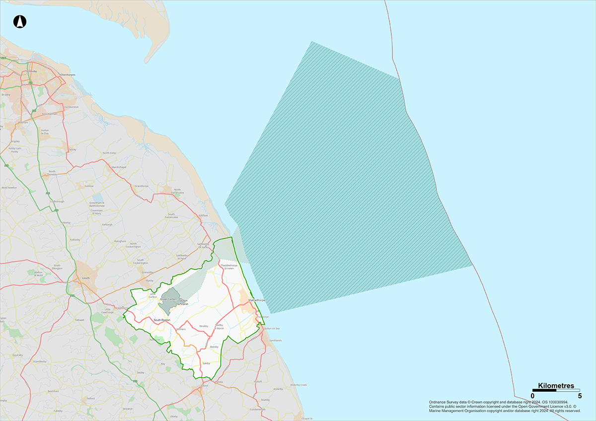
The Search Area was established by the Theddlethorpe GDF Working Group and taken forward by the Theddlethorpe GDF Community Partnership. It includes the Withern & Theddlethorpe and Mablethorpe electoral wards. The Working Group agreed that the focus for the Sub-surface part of a GDF – where the waste would be disposed of – would be in the deep geology beneath the inshore area up to 22km beyond the coast of the Search Area.
Our early work, which is available in the Initial Evaluation Report and subsequent Search Area Evaluation Report, confirmed the potential suitability of this Search Area and inshore area to host a GDF. These reports are available on the Community Partnership website.
NWS then applied its methodology for identifying Areas of Focus to define the Sub-surface, Surface and Accessway Areas of Focus in the Theddlethorpe Search Area and adjacent inshore area. The methodology looks at a range of factors such as geological characteristics, protected areas, environmental constraints and community considerations.
Sub-surface Area of Focus
Alongside the National Geological Screening data for Theddlethorpe Search Area, NWS examined existing legacy seismic and geological data for the area.
This indicates that there is likely to be a volume of rock (the Ancholme Group) with suitable geological characteristics to host a GDF. Further studies will continue to develop our understanding of this sub-surface area as a potential host geology.
The Sub-surface Area of Focus is approximately 460km2. The full area would not be needed, yet at this early stage, looking at a larger volume of rock gives us flexibility in the design and location of the underground vaults and tunnels.

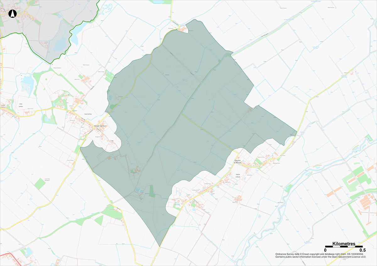
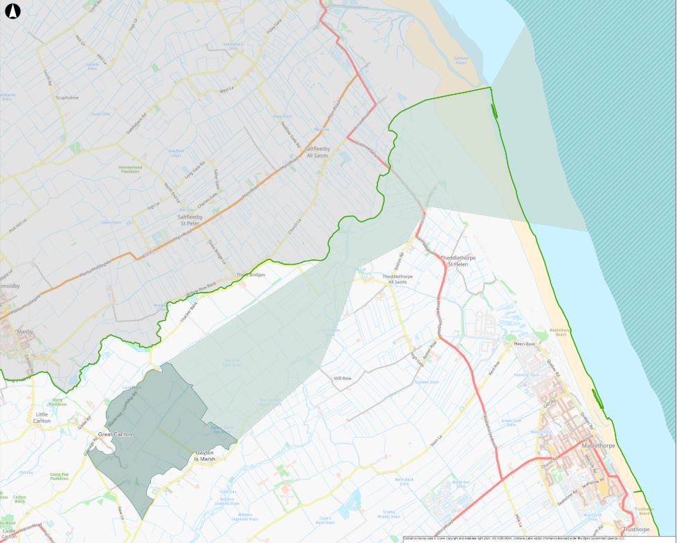
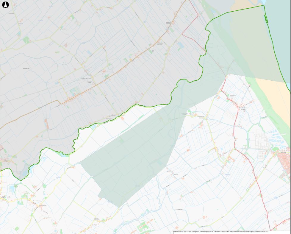
If you have accessibility needs which prevent you from viewing these maps, please attend one of our in-person events or contact the NWS helpdesk.
Surface Area of Focus
Through the application of the Areas of Focus methodology, a number of potentially suitable and less constrained areas were identified in the Theddlethorpe Search Area. Further consideration of these areas that took into account NWS’ Siting Factors, as well as community and programme considerations, resulted in the identification of one Surface Area of Focus in East Lincolnshire that NWS will prioritise and consider further at this time.
Land between Gayton le Marsh and Great Carlton
The Surface Area of Focus is to the north of the A157, south-west of Gayton wind farm, between the villages of Gayton le Marsh and Great Carlton. Whilst maintaining the feasibility of the Surface Area of Focus, we have sought to minimise the number of included residential properties. The land is approximately 3.8km2.
This Surface Area of Focus has been identified to help NWS consider the feasibility of delivering a GDF in the Search Area. It is located away from the coast so it has a lower risk of coastal flooding compared with some other parts of the Search Area.

Accessway Area of Focus
Applying the Areas of Focus methodology, we have identified a potential accessway within which the connection tunnels could be constructed joining the Sub-surface Area of Focus to the Surface Area of Focus. This is significantly wider than will be required to allow for flexibility; it is currently estimated the final accessway will be between 250-500m wide. For the onshore part of the accessway, we have avoided passing directly beneath Mablethorpe, Theddlethorpe All Saints and Theddlethorpe St Helen.
Other areas NWS considered in the Search Area
Three other areas were looked at; however, at this stage, NWS is not prioritising these areas for the following reasons:
Former Gas Terminal site and Adjacent land
The search for a suitable site for a GDF was initially focussed on the former gas terminal. Over the past year, competing interests at the gas terminal site have matured and additional interests have also emerged. In light of this, we have concluded that there is unlikely to be sufficient land to accommodate dual use of the former gas terminal site for both the surface elements of a GDF and other interests.
There are also other constraints currently associated with developing a GDF at the former gas terminal site, and the areas around it. These for example include the area being at higher risk from coastal flooding than areas further inland.
Reston and adjacent land
NWS applied the Areas of Focus methodology and identified this general area as a potential Surface Area of Focus that is relatively free of constraints, such as environmental designations, flood zones and built- up areas. Further reviews, however, highlighted a number of constraints and developing interests that currently make this area more challenging than elsewhere in the Search Area. This area includes the settlement of South Reston and contains cultural heritage features, including scheduled monuments and listed buildings. This area also contains the proposed corridor for the Grimsby to Walpole National Grid upgrade.
Strubby Airfield and adjacent land
NWS applied the Areas of Focus methodology and identified this general area as a potential Surface Area of Focus that is relatively free of constraints, such as environmental designations, flood zones and built-up areas.
Further reviews, however, highlighted a number of constraints and developing interests that currently make this area more challenging than elsewhere in the Search Area.
This area includes Strubby Airfield and the settlement of Woodthorpe with associated businesses and leisure facilities. It is also adjacent to the settlements of Withern and Maltby le Marsh. This area also contains a number of competing interests including the proposed corridors for the Grimsby to Walpole National Grid upgrade and Greenlink 3 and 4 project.
Areas of Focus webinars
We held a series of events and webinars in early 2025 to talk with communities in more detail about Areas of Focus. You can watch the webinar recordings below.
Common themes discussed at events included information about a suitable site and a willing community, Test of Public Support, Site Evaluation and Property Value Protection scheme. If you have any questions, please contact us.


